
Intelligent Rescue Support System Based on Satellite Data for Crisis Situation Assessment and Dynamic Ambulance Fleet Management

The project aims to develop and implement a rescue support system that integrates satellite and road data to dynamically manage an ambulance fleet during a crisis.
The project involves developing a web-based rescue support system that integrates satellite, road, and operational data to dynamically manage an ambulance fleet. The system enables near-real-time analysis of crisis situations and assessment of the operational range of rescue teams, taking into account road and environmental conditions.
Ongoing analysis of ambulance availability and arrival times with real-time crisis situation monitoring
Analysis of archived spatial and environmental data for pattern recognition and planning
The project utilizes optical and radar (SAR) satellite data, road network analysis, and interactive map visualization. The project's goal is to create a scalable prototype system that can support emergency services and crisis management, contributing to improved rescue efficiency and public safety.
The first phase of the project focused on analyzing the impact of crisis situations, particularly floods, on the availability of emergency medical teams and ambulance arrival times. This pilot project served as a precursor to further development of the emergency response support system.
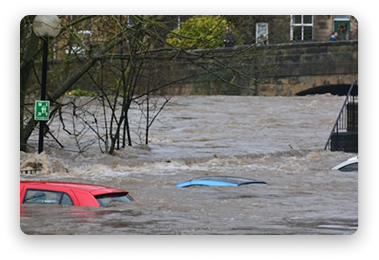


This phase analyzed the extent of flood-affected areas and their impact on road network operations and transportation accessibility. Based on this, maps were prepared showing how the operational range of ambulances changes during crisis situations and how extreme situations affect the time it takes for medical assistance to reach specific areas.
Scientific poster presented at the international conference in Vienna, Austria
Remote presentation to international specialists in geographic information systems
Confirmed potential for further development and international collaboration opportunities

The results of the project were presented to an international group of specialists and confirmed the potential for further development of the proposed solution.
Project Lead